| Page 1 |
Image currently not available [Photo #4] Directly across Highway No. 17 from the entrance driveway to Christ Church (the vantage point of the camera), is Long Point Road leading to Boone Hall Plantation and "Bermuda Town". The Dorrills, Boones, and Rutledges were neighbors in that area. Also in that area is a Darrell Creek that meanders off to the Wando (Cooper) River. _______________________ Image currently not available [Photo #5] Here you can see the proximity of the church and grounds to the highway, probably no more than 20 feet. Notice the state historical marker and the Boone Hall Plantation sign. This is the front entrance to the church. There is another building in the back used for administrative purposes, office, etc. ________________________
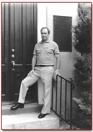
[Photo #6] James S. Dorrill at the front entrance door to the church. Notice the plaque on the wall over his left shoulder. (See the following photo for a close-up of the plaque and the text of the inscription.)
|